5 Best Hiking Trails Near Nairobi, Kenya for an Unforgettable Adventure
Many people go hiking as a form of exercise, but hiking offers more than that. Hiking is therapeutic and rejuvenating. Do you know while you are hiking, your mind is also there? While on the trails, your mind is always conscious about your environment, steps, and target. You hardly think about anything else since your mind is occupied and your heart is excited.
If you don’t believe, then join the hiking community to believe.
Elephant Hills
Distance: 18 km to and from
Minimum elevation: 2500 meters above sea level
Maximum elevation: 12000 ft (3658 meters above sea level)
Time taken: 6-7 hours depending on your pace, resting time, and fitness
Weather: rainy throughout the year
Exercise: aerobics, muscles, core, and lower body exercises.
Do you dream of hiking big mountains like Mount Satima, Mount Kinangop, and Mount Kenya? Then you have to start somewhere as you walk your way up. Despite Elephant Hills not being beginner-friendly, they should be your third level of training destination. Elephant Hills will get you out of your comfort zone in preparation for a more challenging hiking destination.
Elephant Hills are located in Nyandarua County, Njabini Forest Gate. This gate is 4 km from Njabini town. Elephant Hills are approximately 90 km from Nairobi, Kenya. This is a destination that can be accessed by public and private means of transport.
Elephant Hills Trail has 4 levels with different vegetation zones. A very fascinating scene. The starting point of this hike is approximately 3 km from the main gate.
The starting point is at an elevation of 2500 meters above sea level. It consists of forest plantations.
The next level is the Bamboo site. It is at an elevation of 2933 meters above sea level. The part has beautiful scenery, which gives the illusion of a jungle movie. It is dimly lit due to the shade formed by the canopy. It is slippery, and some parts are muddy. You will see footprints of elephants here. It is a hard level.
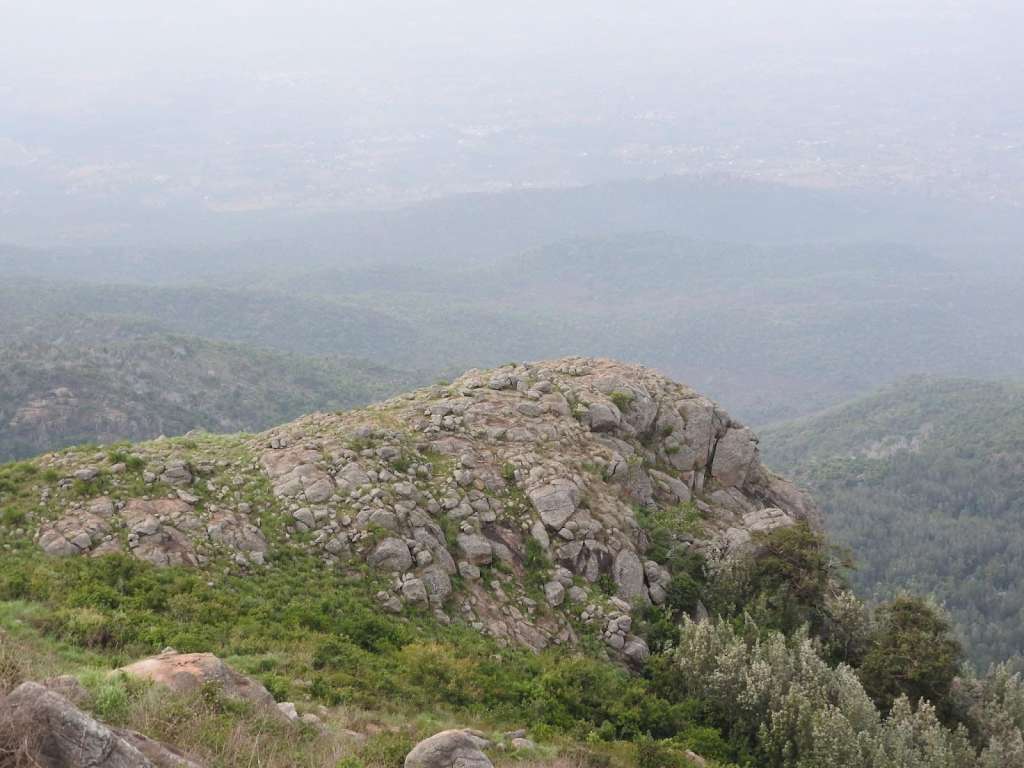
Next is the Desperado (point of despair) at 3255 meters above sea level. As the name means this level, most people, especially beginners, give up. This level invites you to beautiful flowers, hearth and moorland. You can rest at this level and eat something to re-energize. The views from here are beautiful. There is a formation of beautiful patterns of hills and valleys. It looks like the AI greenscreen.
From here, the trail eases as you climb closer to the summit. The rock formation on the trail looks like a stairway. You will feel pressure on your knees, so you should do lunge exercises.
The summit is at an elevation of 12,000 feet (3658 meters above sea level). From the summit to the south, you will see Mount Kinangop and Mount Longonot. To the east, you will see Mount Suswa, Mount Kenya, Ndakaini, and Sasumua Dam.
Mount Ole Sekut
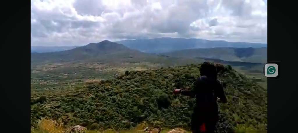
Many ask what good can come out of Kajiado County. Then you should visit Kajiado and see its beauty. The beauty of Kajiado reveals itself from the main road. The hill patterns and the landscape are so beautiful. Our main focus is on Mount Ole Sekut.
Mount Ole Sekut is in Kajiado County, south of Rift Valley, Oltepesi Town. It is the summit of the Kitalu Oloorruka Ranges. It is approximately 50 km from Nairobi and a 1-and-a-half drive.
Mount Ole Sekut Trail
The distance of the hike is approximately 8 km
The hike is moderate
Time taken is 5-6 hours depending on your pace and resting time.
The maximum elevation is 2085 meters above sea level.
Exercises needed: aerobics, lunges, and squats.
Essentials: sunscreen, beach hat, long-sleeved top and bottom, at least 3 liters of water, and enough snacks for energy.
The surrounding area is dry with evidence of acacia trees. Therefore, the temperatures are high, which is the main challenge of this hike.
The mount has four summits. The hard part of this hike is to the peak of the summit, which is a continuous steep ascent.
From the 1st summit, you can see the beautiful views of Mount Suswa, Sleeping Warriors, Mount Longonot, and Ngong Hills. The landscape is so satisfying with a rewarding breeze.
From the second summit, you will enjoy the view of Mount Olorgesailie and the beautiful view of the Magadi area. The view of the landscape is so beautiful that no words can explain this beauty unless you visit and see it yourself.
From the third and fourth summits, the view is the same as the first two summits. The 4th summit is the highest peak. It is the Kitalu Oloorruka Peak at 2085 meters above sea level, according to the sign board at the peak.
From this peak, you have a beautiful view of the Great Rift Valley floor and the surrounding attractions like Ngong Hills, Mount Suswa, Mount Longonot, and the Magadi area. On a clear day, you will see the Aberdare Ranges and Mount Kenya.
Ngong Hills
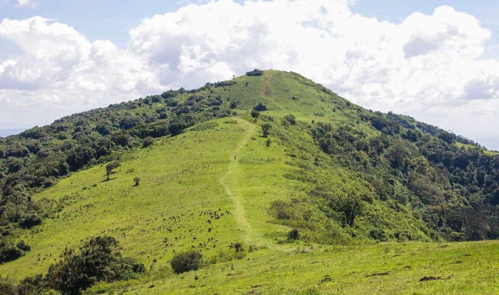
Are you looking for a place to run away from your day-to-day routines? A place that will get you out of your comfort zone, with body fitness and fun activities in an environment with a nice breeze. Then Ngong Hills got you.
Ngong Hills are located in Ngong, approximately 25 kilometers from Nairobi town. One can get there through Uber to Ngong Hills Reserve. You can take public transport; there are buses located at Agro House Tom Mboya Street to Ngong town. You can also pick a matatu number 111 at Railways opposite Memorial.
Ngong hill trail
Distance: 12 km
Time taken: approximately 4-5 hours
Maximum elevation: 2460 meters above sea level
Minimum elevation: 2077 meters above sea level
Difficulty: hard
You can start your hike from Ngong Town to the entrance of Ngong Hills or at the Kengen Generator through the residents to the dusty road.
You will pass the turbines or the windmills. The 3rd hill trail is always steep, rocky, and slippery. This hill needs stamina and fitness. It also needs good shoes with a firm grip and tight shoe laces.
The 4th hill is windy even during summer. The wind makes the place cold. A light jacket is recommended. From this hill, there is a sitting area, which is also very scenic, where one can rest.
After passing the windy area, one can see some of the indigenous trees, like cyprus, and lucky enough, some animals, like buffalos and squirrels. After this trail, you will come across people herding animals like cows and goats.
Hill 5 is tough, and it is also the peak hill. There are people who massage at the foot of the hill for those who feel worn out and unable to continue.
At hill 7, be prepared for the scenic view of Suswa Hill, SGR railway transport, and the Great Rift Valley. At the foot of the Rift Valley is the Maasi community settlement.
One can go back through Kona Baridi, which takes one to Kiserian or Ngong town through the 7 hills.
Mount Longonot
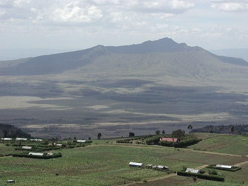
Mount Longonot is a scenic mountain that is visible from the Nakuru-Naivasha road. This is a mountain that will raise your curiosity from the main road with its beautiful scenery.
Using public transport, you can board a matatu from Nairobi-Naivasha via Mai Mahiu and ask them to drop you off at Longonot Centre. From here to Mount Longonot, you will have a 20-minute walk.
Mount Longonot Trail
The trail starts with a flat, dusty road along the savannah. If you start your hike early, you will be lucky to see the gazelle, zebra, impala, and buffaloes grazing on the savannah. Do not get close to the animals; it is not safe and not allowed.
At the end of the dusty road, you will start ascending the steep ascent to the crater and the summit. The trail is rough and slippery due to the sand that is formed from the weathering of the volcanic rocks. A few kilometers into the ascent, there are stairs after the picnic area. The stairs were made to allow children to climb higher and have a view of the Savannah and the beautiful landscape.
When you reach the summit, your jaw will drop with the view inside the crater and down the savannah. It is something you will look up to. My curiosity at this point was fed, but I still could not resist the urge to go down in the crater.
The distance around the rim is 7.1 km. If you are fit and have enough energy, you can go around the rim to have a view of the crater from different angles.
From the summit, you will have a view of Lake Naivasha and the Ngong Hills.
The total hiking distance is 13.5 km, with the highest elevation of 2780 meters and a low elevation of approximately 2150 meters. The hike will take you 4-6 hours with resting time. This time may vary depending on your hiking speed.
Ragia Falls
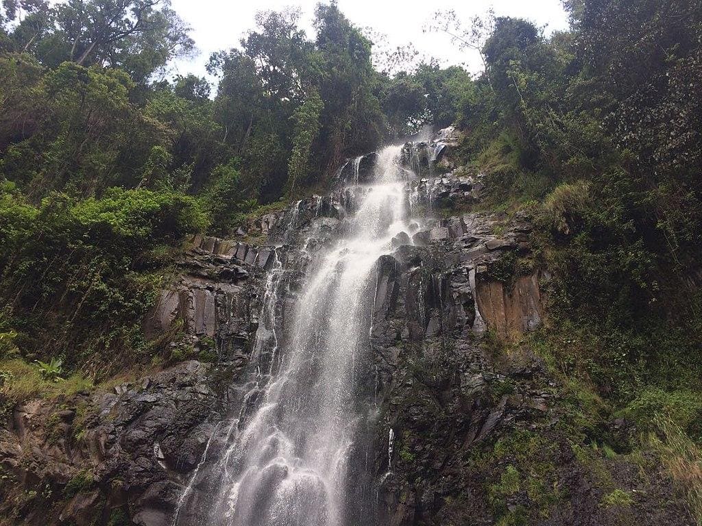
Ragia Forest, one of the circuits of the Aberdare Ranges, got you. This is a forest that is served with waterfalls, which are the Ragia waterfalls, the beautiful mangrove forest, the elephant trail, and the lush grass along the trails.
Ragia Forest and the Ragia waterfalls are located in Lari Kiambu County. The forest borders the Kieni forest to the east and the Kinangop plateau to the west of Nyandarua. Starting your hike through Sasumus Dam to China Champ, you will experience the breathtaking view of the Sasumua Dam. From the road and along the hiking trails, you will have a beautiful view of the Elephant Hills in the Aberdare Range forest.
The Ragia Forest old bridge
From the Sasumua Dam, through China Camp, you will get to this old bridge. This bridge was constructed during the colonial period back in 1952. It helped to connect through the forest across the big stream for easier access. The piping system also passes here, which supplies water. You will come across some of them along the trails.
The Ragia Falls
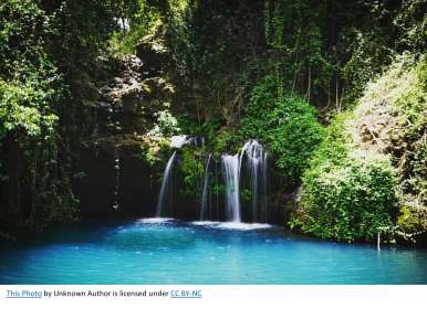
Ragia Forest has two major waterfalls deep in the forest. The waterfalls are surrounded by nature that has not been tampered with. Therefore, nature is at its best to protect itself at all costs. The struggle to get to the waterfalls will show the truth of this statement.
There are three trails and back to the starting point. The trail through the elephant grass is easy and friendly. The trail to the first waterfall is hard with a steep, slippery descent. On this trail, you will pass thick vegetation and close a river, which is not an easy task.
The third trail is to the second waterfall. You will get back to the main road from the first waterfall. In this hike, ascending the slopes is easier than descending. Getting to the second waterfall is easier than the first one. Extra care is needed on this hike and teamwork to support each other along the hike.
This is a hike that will give you a close bond with nature and knowledge about our journey to independence as Kenyans.
This hike requires fitness and endurance. Before this hike, you will need at least one week of aerobic exercise. You will need to exercise your muscles, core, and lower body. Carry at least 2 liters of water and enough snacks for energy. Wear flexible clothes and layers that are easy to add or subtract. Carry a raincoat because the weather may change while hiking.
Kenya has a lot of destinations to explore and enjoy. All you need to do is get out of your comfort zone and explore these places. You have no excuse because if it is people to go with, we got you to book with us and let us explore together.


